Flight Over Toccoa


Currahee Mountain is a mountain located in Stephens County, Georgia, near Toccoa. The name appears to be derived from the Cherokee word ᏊᏩᎯ (quu-wa-hi) meaning "stand alone."[2][3] Technically a part of the Georgia Piedmont or "foothill" province, Currahee Mountain rises abruptly about 800 vertical feet (240 m) above the local topography and is the highest peak in Stephens County. Part of the mountain is in the Chattahoochee National Forest. On clear days, the peak's 1,735-foot (529 m) summit is visible for many miles and is a prominent landmark to the southeast of Georgia's Blue Ridge Mountain crest.
Stephens County High School serves 1,158 students in grades 9-12. The percentage of students achieving proficiency in Math is 44% (which is higher than the Georgia state average of 41%) for the 2015-2016 school year. The percentage of students achieving proficiency in Reading/Language Arts is 39% (which is lower than the Georgia state average of 40%) for the 2015-2016 school year. Stephens County High School placed in the top 50% of all schools in Georgia for overall test scores (math proficiency is top 50%, and reading proficiency is top 50%) for the 2015-2016 school year.
Stephens County High School. I took this photo at 2:30 pm on a Friday, could not believe no one in sight.
Stephens County gathering place for softball, tennis, walking, football, soccer
Currahee Mountain without towers.
Toccoa Airport
R.G. LeTourneau FieldIATA: TOCICAO: KTOCFAA LID: TOCSummaryAirport typePublicOwnerToccoa-Stephens County AuthorityServesToccoa, GeorgiaElevation AMSL996 ft / 304 mCoordinates34°35′34″N 083°17′47″WRunwaysDirectionLengthSurfaceftm3/215,0081,526Asphalt9/272,951899AsphaltStatistics (2009)Aircraft operations26,000Based aircraft32Source: Federal Aviation Administration[1]
Toccoa Airport (IATA: TOC, ICAO: KTOC, FAA LID: TOC), also known as R. G. LeTourneau Field, is a public use airport located two nautical miles (3.7 km) northeast of the central business district of Toccoa, a city in Stephens County, Georgia, United States. It is owned by the Toccoa-Stephens County Authority.[1] According to the FAA's National Plan of Integrated Airport Systems for 2009–2013, it is categorized as a general aviationairport.[2]
Local businessman and aviation buff R. G. LeTourneau created the airport in the late 1930s when he built two runways for his personal use. LeTourneau donated the runways to the city and county in 1961 and the airfield was named in his honor.[3]
FOT_14
For more than a century, we’ve been supplying cement, aggregates, ready mixed concrete, asphalt and other building materials to markets throughout North America. Today, as a part of HeidelbergCement, our reach and capabilities are more extensive than ever, and our brightest days are still ahead. Local business where rocks are crushed for different applications.
Path cut to maintain a 30’ right away for power lines.
“North Broad Curve” was located at a point where the single track crossed North Broad river as it turned south, on what is now known as Rock Quarry Circle, towards Currahee Mountain.
The sharp North Broad Curve came to be replaced by the “Wells Viaduct” and was constructed between the years 1915 to 1919. The Chief Engineer of the project was W.H.Wells. The trestle is the highest trestle on the line between Washington D.C. and New Orleans, Louisiana.
The trestle is approximately 1,400 feet long and is supported by ten reinforced concrete piers with heights of up to 200 feet above the valley of the North Fork of the Broad River.
Toccoa Falls is a waterfall with a vertical drop of 186 feet (57 m), on the campus of Toccoa Falls College in Stephens County, Georgia. Toccoa was the Cherokee word for "beautiful" and Toccoa Falls is one of the many waterfalls of North Georgia.
Toccoa Falls from a view not seen by many
The Links at Lake Toccoa is a classically-designed nine hole golf course that is newly renovated and features Tifeagle greens, a fully renovated clubhouse and grill, and access to beautiful Lake Toccoa.
The Links at Lake Toccoa is a classically-designed nine hole golf course that is newly renovated and features Tifeagle greens, a fully renovated clubhouse and grill, and access to beautiful Lake Toccoa.
Lake TugaloLocationGeorgia/South CarolinaCoordinates34.730°N 83.352°WCoordinates: 34.730°N 83.352°WBasin countriesUnited StatesSurface area597 acres (2.42 km2)
Lake Tugalo is a 597-acre (2.42 km2) reservoir with 18 miles (29 km) of shoreline located in the northeastern Georgia in Habersham and Rabun counties, but also lies partially in Oconee County, South Carolina. It is the fifth lake in a six-lake series created by hydroelectric dams operated by Georgia Power that follows the original course of the Tallulah River. The series starts upstream on the Tallulah River with Lake Burton followed by Lake Seed, Lake Rabun, Lake Tallulah Falls and Lake Tugalo, ending with Lake Yonah. The western arm of Lake Tugalo is filled by the Tallulah River and the eastern arm is filled by the Chattooga River. Georgia Power considers the lake full at a surface elevation of 891.5 feet (271.7 m).
Lake Tugalo began filling in 1923 with the completion of the Tugalo Dam, a gravity concrete and masonry dam. The dam is 155 feet (47 m) high and has a span of 740 feet (230 m). The Tugalo Hydroelectric Plant has a generation capacity of 45 megawatts.
View of Gorge with suspension bridge in foreground.
Tallulah Gorge as seen from above
Tallulah Falls LakeLocationRabun County, GeorgiaCoordinates34.7387°N 83.3961°WCoordinates: 34.7387°N 83.3961°WTypereservoirPrimary inflowsTallulah RiverPrimary outflowsTallulah RiverBasin countriesUnited StatesSurface area63 acres (250,000 m2)Shore length13.6 mi (5.8 km)Surface elevation1,483 ft (452 m)1 Shore length is not a well-defined measure.
Tallulah Falls Lake is a 63-acre (250,000 m2) reservoir with 3.6 miles (5.8 km) of shoreline located in the Northeastern corner of Georgia in Rabun County. It is the fourth and smallest lake in a six-lake series created by hydroelectric dams operated by Georgia Power that follows the original course of the Tallulah River. The series starts upstream on the Tallulah River with Lake Burton followed by Lake Seed, Lake Rabun, Tallulah Falls Lake, Lake Tugalo and Lake Yonah. Georgia Power considers the lake full at a surface elevation of 1,500 feet (460 m).
Tallulah Falls Lake was formed in 1914 with the completion of the Tallulah Falls Dam, a concrete dam with diversion tunnel. The diversion tunnel is 11 feet (3.4 m) wide, 14 feet (4.3 m) high, and 6,666 feet (2,032 m) long and was tunneled through solid rock and then lined with concrete. The dam is 126 feet (38 m) high and has a span of 426 feet (130 m). The Tallulah Falls Hydroelectric Plant is located 608 feet (185 m) lower than the dam at the lower end of the tunnel and has a generation capacity of 72,000 kilowatts
Power grid located above the penstocks at the Tallulah Falls power station.
The Tallulah Falls Hydroelectric Plant is the oldest and largest in the North Georgia Hydro Group. The plant began operating in early 1913. In early 1914 all five of the 12,000 kilowatt generating were completed, and Tallulah Falls became the third largest hydroelectric facility in the United States.
The lake is created by the Yonah Dam, which is owned and operated by Georgia Power, and generates 22 megawatts. Lake Yonah is a residential lake with 72 vacation and permanent homes.
Lake Yonah is a lake on the Tugaloo River, separating Georgia and South Carolina.
The lake is created by the Yonah Dam, which is owned and operated by Georgia Power, and generates 22 megawatts.[2] Lake Yonah is a residential lake with seventy-two vacation and permanent homes. After the Tugaloo Riverflows from Yonah through the lower dam, it continues to Lake Hartwell, and joins the Savannah River, which empties into the Atlantic Ocean. Another tributary to this great river is the Seneca River, which flows into it from South Carolina. Lake Yonah is also a source of fresh water for the town of Toccoa, which is approximately twenty miles away. River.
This area around the Broken Bridge is part of the Tugalo Corridor.
Lodge at the Club
Quarry Hole
10th fairway
View of the 18th Fairway and 18th Green.
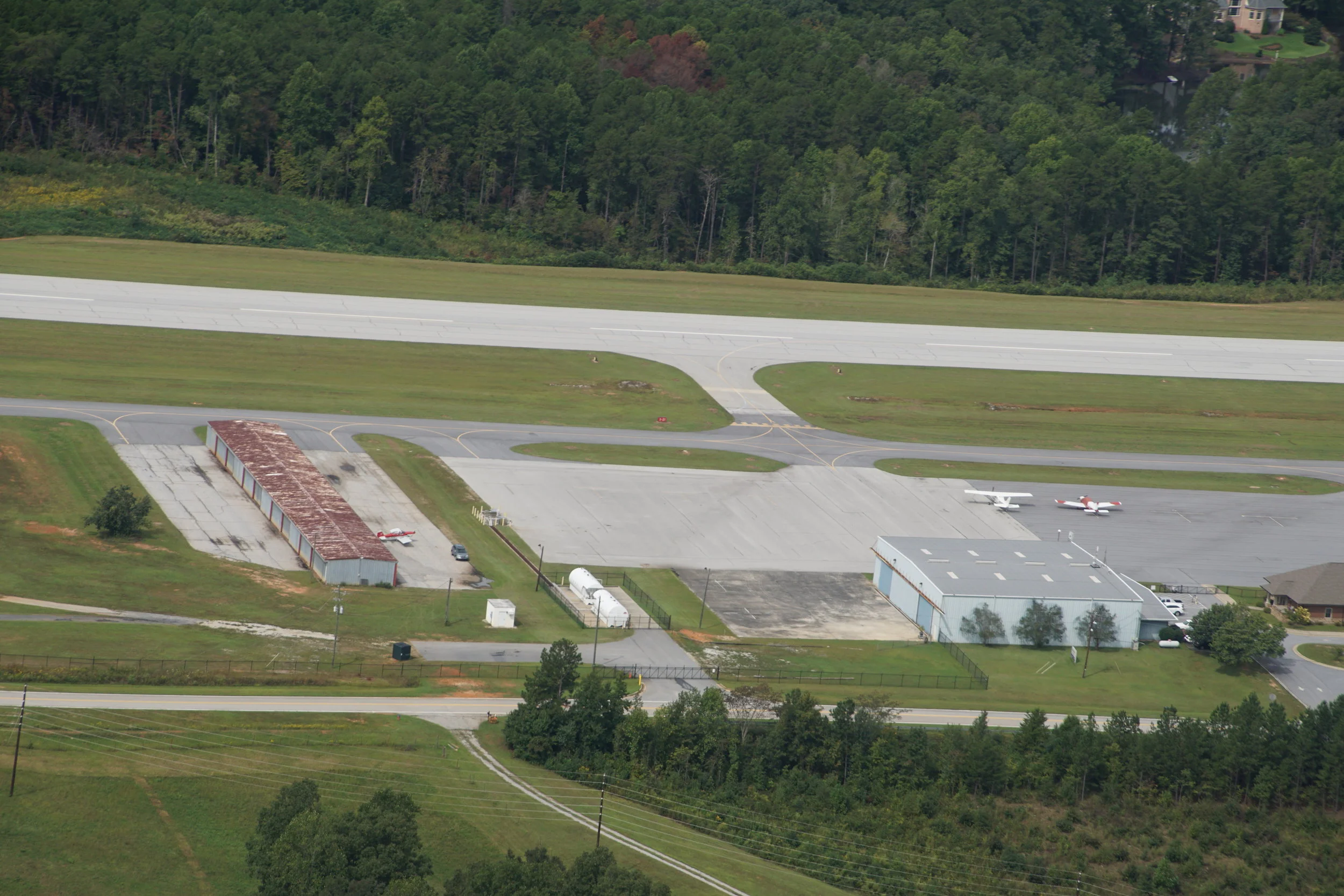
Toccoa Airport also known as R. G.LeTourneau Field, is a public use airport located two nautical miles northeast of the business district of Toccoa . It is own by the Toccoa-Stephens County Authority.
First Baptist Church can be viewed in center of photo.
Toccoa Elementary School can be viewed in photo.
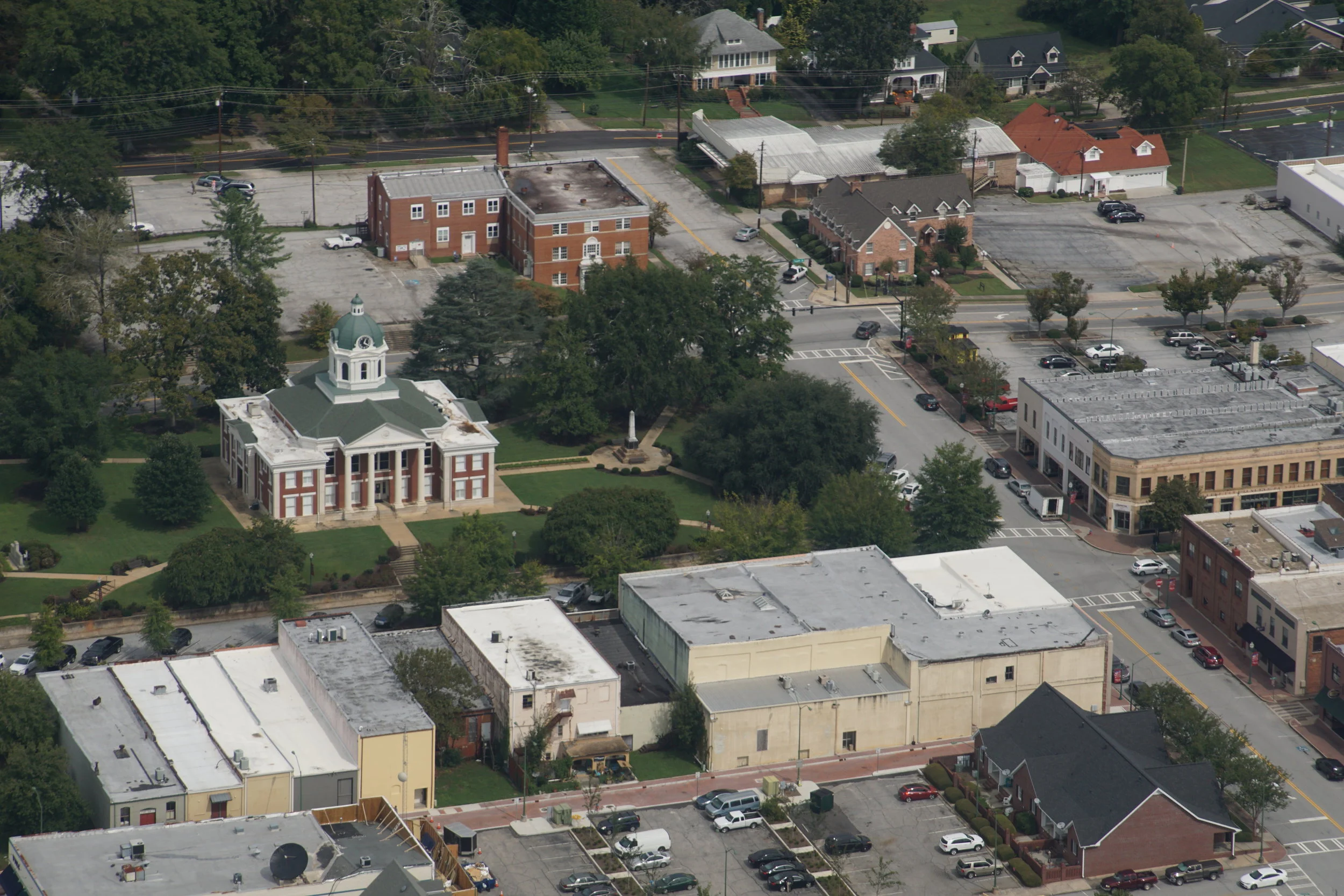
The restored Stephens County Courthouse and the Stephens Governmental building can be viewed. The City of Toccoa Government building is on theleft
Stephens County Courthouse